Zachary Maldonado
HIST 370, Duke University
Tenochtitlan Hydological Expertise, and the unforseen challenges of the spanish operation
"This great city of Tenochtitlan [Mexico] is situated in this salt lake, and from the main land to the denser parts of it, by whichever route one chooses to enter, the distance is two leagues. There are four avenues or entrances to the city, all of which are formed by artificial causeways, two spears’ length in width. The city is as large as Seville or Cordova; its streets, I speak of the principal ones, are very wide and straight; some of these, and all the inferior ones, are half land and half water, and are navigated by canoes. All the streets at intervals have openings, through which the water flows, crossing from one street to another; and at these openings, some of which are very wide, there are also very wide bridges, composed of large pieces of timber, of great strength and well put together; on many of these bridges ten horses can go abreast. Foreseeing that if the inhabitants of this city should prove treacherous, they would possess great advantages from the manner in which the city is constructed, since by removing the bridges at the entrances, and abandoning the place, they could leave us to perish by famine without our being able to reach the main land..."
-Hernan Cortes, in his Second Letter to King Charles V of Spain

Image from Hernán Cortés' 1524 Nuremburg map of Tenochtitlan, included among his letters back to King Charles V of Spain.
This website serves as an immersive experience that explores the role indigenous hydrological expertise played in the Spanish conquest of the Mexica city of Tenochtitlan. What defensive advantages did these innovations give the Mexica? How did the Spanish overcome Mexica hydrological adaptations? What were the fatal weaknesses that brought this city to its defeat, and how were they exploited? Get a sense of this vital history through the argument and supporting sources used here.

Research Statement
Ingenious technological adaptations were no doubt a staple of the great city of Tenochtitlan. The aquatic environment called for the implementation of hydrological developments such as canals, aqueducts, and causeways that were conducive to sustaining a thriving presence in the region. During the Spanish conquest of Tenochtitlan, many of these innovations created defensive advantages that allowed the Mexica to hinder Spanish movement. However, this combative edge developed into key weaknesses that were exploited during the Spanish seige of the city, and ultimately the advantage gained by unique Mexica hydrological expertise was overcome by the unforeseen challenges that the Spanish operation would bring to the table.
Contextual Details
As a city founded by immigrants in a hostile region, Tenochtitlan is a testament to Mesoamerican construction expertise. Its history is relatively short, having ended after just 200 years upon the arrival of the Spanish and the city’s subsequent destruction. In that short time (about 1325 AD to 1519 AD), a people who were previously nomads adapted to the aquatic environment of lake Texcoco, producing an impressive array of technological works that each had a hand in the city’s prosperity. This website will focus on hydrological innovations, as this perspective is useful in investigating Tenochtitlan as a unique technological marvel, as well as a defensible position during the Spanish conquest.
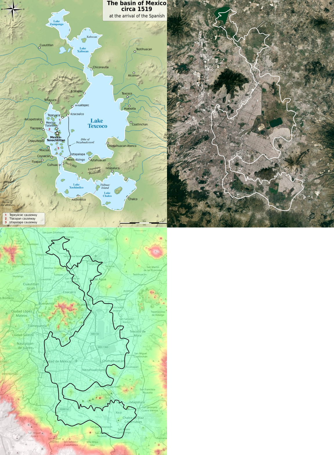
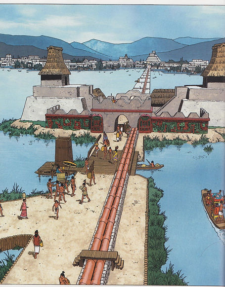
Aqueducts would bring freshwater from mainland springs to support the rapidly growing population. Aqueducts like Chapultepec—which consisted of a twin set of pipes—required a great deal of ingenuity from not only the Mexica but also prominent engineers from neighboring kingdoms. Construction materials like wood, stone and lime had to be obtained from the mainland and usually involved conflict with neighboring tribes. Measures to protect the city from flooding during the rainy season also proved to be vital towards survival in the region, so the Mexica constructed several roads to mitigate this flooding whilst also aiding ease of transportation to and from the mainland. These roads featured openings for canoes to transport goods across, and also confined the freshwaters of the Southwest and Western regions of the lake, which is said to have improved fishing. The most important flood control measure was the Netzahualcoyotl dike, which spanned 16 km and was 20 meters wide, which also helped with water quality management.
The Mexica were not the first to employ chinampa farming techniques, but the massive extent of their hydroponic system deserves praise nonetheless. Its success, coupled with tribute over a vast sphere of influence, helped Tenochtitlan’s population skyrocket past most major cities of the world at the time of the Spanish arrival. These artificial islands, created by layering mud, aquatic vegetation, and reeds, provided year-round cultivation and sustained Tenochtitlan’s large population. The Florentine Codex emphasizes the ingenuity of the chinampas, portraying them as a testament to the Mexica ability to harmonize with their environment.
Above information sourced from chapter 13 of Hydrologic and Hydraulic Works of the Aztec Civilization, by Jose A. Raynal-Villasenor